Library Catalog
Latest Documents and Publications listed. Use search terms in the box below to find what you need
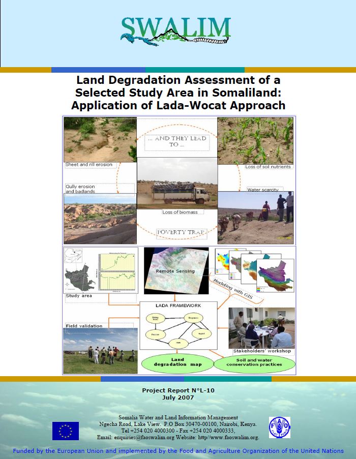
L-10 Qiimayn Xaaluf Dhul ee Goob loo Xushay Daraasayn gudaha Soomaaliya
Sida hage waxtar u leh dadaalo ilaalin oo ku saabsan maareyn kheyraad dhul gudaha Somaliland, warbixintan waxay qeexaysaa noocyada baahsan ee xaalufka dhulka, waxa sababa iyo saamaynyahooda. Daraasadan oo dhamaystiran waxay lug leedahay laba heer oo qiimayn ah. Mid daboolaysa deegaanka oo dhan iyadoo la isticmaalayo habka khibradeed wax qiimeyn ee LADA-WOCAT iyo midda kale oo diiradda lagu saarayo aag maxali ah oo la isticmaalayo habab isku-dar ah sida LADA-WOCAT qiimayn khabiir, falanqayn masawirro dayax-gacmeed ee waqtiyo-taxane ah (1982 ilaa 2008), iyo falanqaynt xog sifooyin ciid oo taariikhiga ah. Noocyada ugu badan xaalufka dhulka la aqoonsaday waxaa ka mid ah dhir baabi’id, ciid hallaw, iyo hoos u dhac nafaqo ciid.
Publication Type:
Technical report
Publication Date:
Author:
Corporate Author:
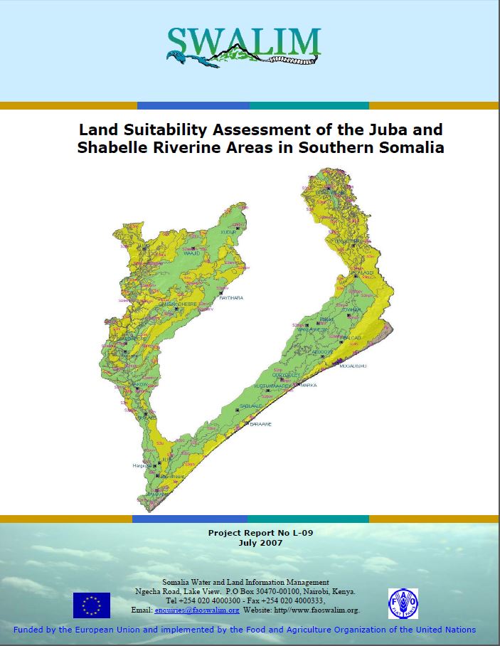
L-09 Qiimayn Haboonaanshiyo Dhul ee Juba iyo Shabeelle
Warbixintan waxay qeexeysaa u haboonaanshiyo dhul oogadiis beer roobaad, beer waraab, daaq furan (xoolo-daaqsato) iyo kaymo meelaha gosha Webiyada Juba iyo Shabelle. Haboonaanshiyo dhul ayaa loo soo bandhigay qaab ah shax, khariidado iyo warbixin ku aadan noocyo isticmaa dhul gaar ah oo loo qeexay dalagyo kala gaar ah, xoolo daaqid ama noocyo kayn ah. Warbixintan waxay sidoo kale bixinaysaa faahfaahino ku saabsan Hab Qiimayn Dhul oo Automaatik looga dhigay Soomaaliya (Somalia Automated Land Evaluation System (SOMALES )), taas oo ah hirgelin Qaab-hawleed FAO u isticmaasho Qiimayn Dhul iyo ALES software oo Soomaaliya loo diyaariyey. Warbixintan waa wax waxtar leh hogaamin go'aanno siyaasadeed oo ku taxaluqa qorshayn isticmaal dhul.
Publication Type:
Technical report
Publication Date:
Author:
Corporate Author:
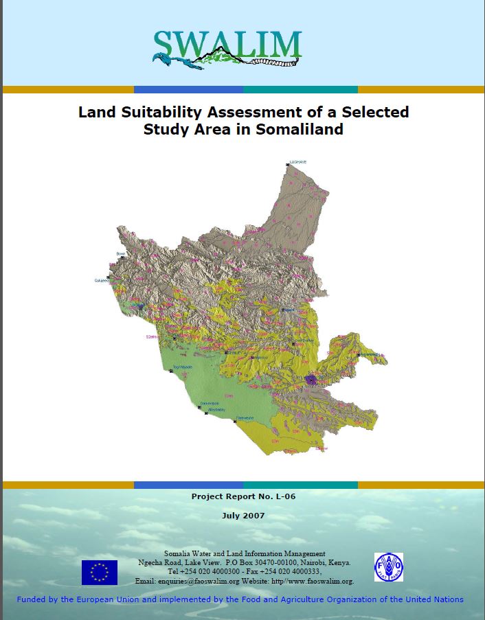
L-06 Land Suitability of a Selected Study Area in Somaliland
As an input to guiding policy decisions on land use planning, this study defi nes the capacity of the study area to support specific land use types. The main land use types considered were rainfed agriculture, extensive grazing (pastoralism) and forestry. Land suitability is presented in the form of tables, maps and narratives for specifi c types of land use defi ned by individual crops, grazing animals or forestry species. This report also gives details of the Somalia Automated Land Evaluation System (SOMALES), which is an application of the FAO Framework for Land Evaluation and Automated Land Evaluation Software (ALES) for Somalia
Publication Type:
Technical report
Publication Date:
Author:
Venema, J.H, Vargas R .R.
Corporate Author:
SWALIM
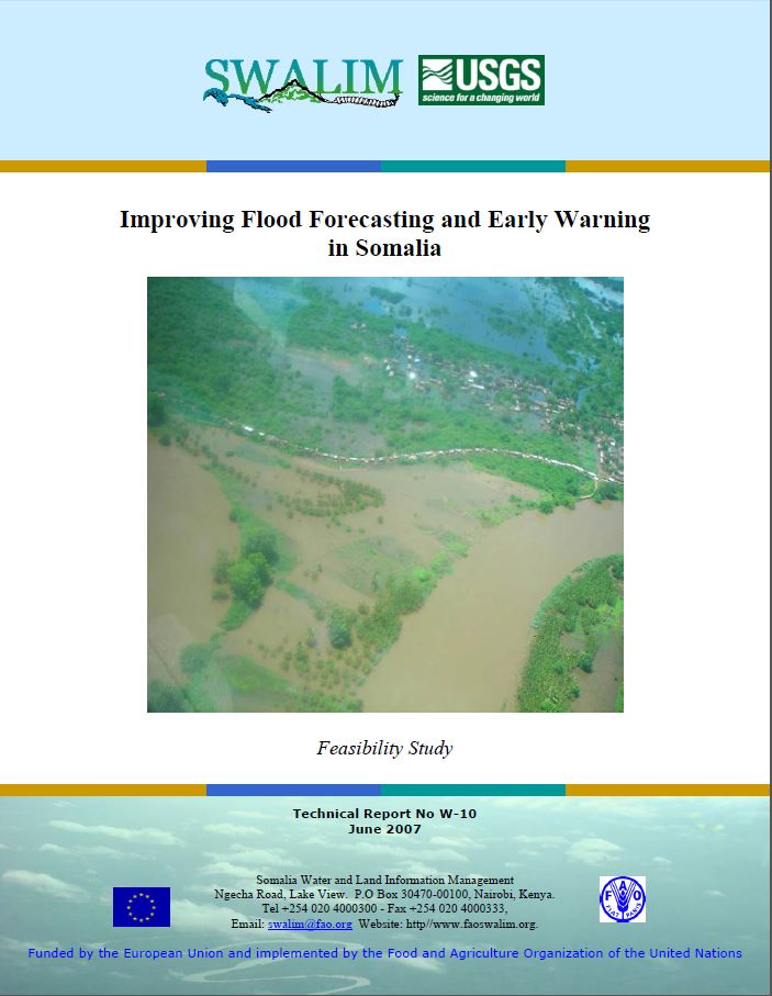
W-10 Improving Flood Forecasting and Early Warning in Somalia
Somalia experiences severe fl ooding in the riverine areas of the Juba and Shabelle. Increased severity and frequency of these floods have in turn led to increased economic damage and human casualties whenever these fl oods occur. This report presents technical options for the development of fl ood forecasting and early warning systems in Somalia. It is the outcome of an assessment carried out by SWALIM and the United States Geological Survey (USGS) on the Juba and Shabelle rivers for river fl ow forecasting and an assessment of Garowe and Hargeisa towns for fl ash fl ood alert systems.
Publication Type:
Technical report
Publication Date:
Author:
Gadain H.M., Muchiri, P. W., Muthusi F.M.
Corporate Author:
SWALIM

Publication Type:
Conference Proceedings
Publication Date:
Author:
Paron P. (Editor), FAO SWALIM, Rojas V. (Editor), FAO SWALIM, Pellikka P.
Corporate Author:
Somalia Water and Land Information Management, Nairobi (Kenya)
W-10 Hagaajinta Odoroska Fataadda iyo Digniinta Hore ee Soomaaliya
Soomaaliya waxaa la kulantaa fatahaad aad u daran gudaha dhulka dooxada webiyada Juba iyo Shabeelle. Koror daran iyo soo noqnoqoshada daadadkaan waxay iyana markooda keeneen koror khasaare dhaqaale iyo dhaawacyo aadane markasta oo daadadkaani dhacaan.Warbixintani waxay soo bandhigaysaa fursado farsamadeed ee horumarinta hababka odoroska fatahaadda iyo digniinta hore ee Soomaaliya. Tani waa natiijada ka dhalatay qiimayn ay SWALIM iyo Hayadda Sahminta Joolojiyadeed ee Maraykanka (United States Geological Survey ( USGS )) ku sameeyeen Webiyada Juba iyo Shabeelle ee hillaadinta qulqul webi iyo qiimeynta habab u heeganaan daad butaaco ah ee magaalooyinka Garowe iyo Hargeysa.
Publication Type:
Technical report
Publication Date:
Author:
Corporate Author:
Publication Type:
Other
Publication Date:
Author:
Gadain H, Somalia Water and Land Information Management, Nairobi (Kenya), Aduwo D, Somalia Water and Land Information Management, Nairobi (Kenya), Hagen C, Somalia Water and Land Information Management, Nairobi (Kenya)
Corporate Author:
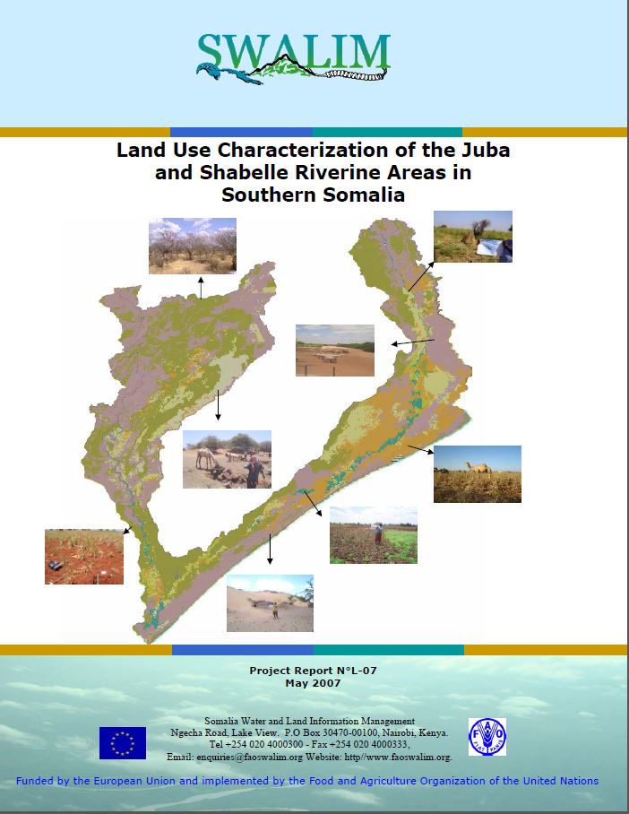
L-07 Land Use Characterization of the Juba and Shabelle
Land use types in the Juba and Shabelle riverline areas were identifi ed through land cover analysis, interviews with land users and the use of past and current satellite images. The report also shows the characterisation of different land use present in the Juba and Shabelle riverine areas. Land-use classes in the study area were determined through land cover analysis, semi-structured interviews and interpretation of satellite imagery, and are described with their specifi c attributes. Users will obtain a detailed overview of land use activities in the study area.
Publication Type:
Technical report
Publication Date:
Author:
Oduori S. M., Vargas R.R, Alim M.S
Corporate Author:
SWALIM
L-07 Sifeyn Isticmaal Dhul ee Jubba iyo Shabelle
Noocyo isticmaal dhul ee gudaha gosha Webiyada Juba iyo Shabeelle aayaa la aqoonsaday iyadoo loo marayo falanqayn ded dhul, wareysiyo lala yeeshay isticmaaleyaal dhul iyo adeegsiga masawirro dayax-gacmeed oo ah waqti la soo dhaafay iyo kuwo hadda. Warbixintu waxay sidoo kale muujinaysaa kala soocista isticmaalka dhul kala duwan oo hadda ka jirta gudaha meelaha gosha Juba iyo Shabeelle. Waxaa la xaqiijiyey dabaqadaha isticmaalka dhulka gudaha aagga la daraasay iyadoo loo marayo falanqayn ded dhul, wareysiyo yara-qaabaysan iyo tarjumid sawirro dayax-gacmeed, waxaana la sharaxay sifooyinkooda u gaarka ah. Isticmaaleyaalku waxay heli doonaan muuqaal guud oo faahfaahsan oo ah hawlaha isticmaalka dhulka gudaha aagga daraasadda.
Publication Type:
Technical report
Publication Date:
Author:
Corporate Author:
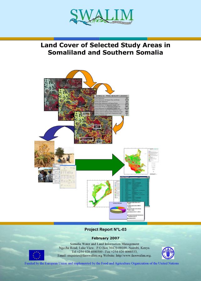
L-03 Ded Dhul Aagag Daraasad loo Doortay gudaha Somaliland iyo Koonfurta Soomaaliya
Daraasaddan, waxaa lagu abuuray darajooyin ded dhul iyadoo la isticmaalayo Hab Abla-abley Ded Dhul ee FAO (Land Cover Classification System (LCSS) of FAO), tarjumaad masawirro dayax-gacmeed, iyo soo hubin duur. Sharaxaadda noocyada ded dhulka ugu muhiimsan iyo xubno dhir iyo goobahooda ayaa la bixiyay faahfaahin labadii goobood daraasadda - mid gudaha Somaliland ah iyo mid kale oo gudaha Koonfurta Soomaaliya ah. Khariidadaha dedka dhulka lagu soo saaray daraasadan waxay anfici doonaan curiyo khariidado isticmaal dhul iyo inta lagu jiro falanqayn haboonaanshiyo dhul. Warbixinta waa khayraad qiimo badan u leh maareynta khayraad dabiiciyeedka.
Publication Type:
Technical report
Publication Date:
Author:
Corporate Author:
Pages
 RSS feed [compliant with the Agris AP] |
  Agris AP XML