Library Catalog
Latest Documents and Publications listed. Use search terms in the box below to find what you need

Somalia Dekadal Rainfall Bulletin - Dekad 29 2014
During the 2nd Dekad of October (11th – 20th October 2014), there was a slight reduction of rainfall activities in the northwestern parts. Other areas continued to receive the Deyr rains. Moderate to heavy rains were recorded in many parts of the country. Below is a brief summary of the rainfall situation by region for this dekad.
Publication Type:
Dekadal Rainfall Update
Publication Date:
Author:
Corporate Author:

Flood Watch Bulletin 28-10-2014
During the week ending on 27th October, 2014, moderate to heavy rains were experienced in both Juba and Shabelle river basins inside Somalia and within the Ethiopian highlands leading to floods in some parts.
The worst flood affected areas along the Shabelle River are Belet Weyne in Hiraan region; and in Middle Shabelle region where there has been several river breakages. Along the Juba River, floods have been reported in Dollow (Gedo region), Jilib and Jamame in Lower Juba. Other reports also indicate localized flooding in Huduur in Bakool region following heavy rains in the area.
Publication Type:
Flood watch bulletin
Publication Date:
Author:
Corporate Author:
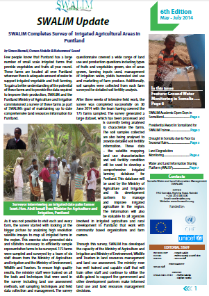
SWALIM Update Issue 6
We are pleased to share Issue 6 of our quarterly newsletter “SWALIM Update” for the period May 2014 - July 2014. The newsletter provides updates on SWALIM water and land information management activities such as: SWALIM Completes Survey of Irrigated Agricultural Areas in Puntland; SWALIM Capacity Building Efforts lead to a Presidential Award in Somaliland; SWALIM Establishes Land Degradation Monitoring Systems in Somaliland; The Water and Land Intervention Information Sharing Platform (WALISP); A Feature Article: Groundwater Monitoring in Somalia among others. We hope you will enjoy this edition. You feedback will be highly appreciated.
Publication Type:
Newsletter
Publication Date:
Author:
Corporate Author:

Somalia Dekadal Rainfall Bulletin - Dekad 15 2014
During the 15th Dekad (21st – 31st May 2014), there was a reduction of rainfall activities in most parts of the country except for the north eastern parts that recorded moderate to heavy rains. In summary, the month of May recorded
below normal rainfall across the country. A few stations however recorded above normal rains but with poor temporal and spatial distribution. Below is a brief summary of the rainfall situation by region for this dekad.
Publication Type:
Dekadal Rainfall Update
Publication Date:
Author:
Corporate Author:

Somalia Dekadal Rainfall Bulletin - Dekad 16 2014
During the 1st Dekad of June (1st – 10th June 2014), there was a significant reduction of rainfall activities in most parts of the country except for the northern parts and a few places in the south that recorded light to moderate rains. This is however normal at this time of the year as the Gu season comes to an end. Below is a brief summary of the rainfall situation by region for this dekad.
Publication Type:
Dekadal Rainfall Update
Publication Date:
Author:
Corporate Author:

Somalia Dekadal Rainfall Bulletin - Dekad 17 2014
During the 2nd Dekad of June (11th – 20th June 2014), there was a significant reduction of rainfall activities in most parts of the country marking a possible cessation of the season. However, parts of north west recorded light to moderate rains. Below is a brief summary of the rainfall situation by region for this dekad.
Publication Type:
Dekadal Rainfall Update
Publication Date:
Author:
Corporate Author:
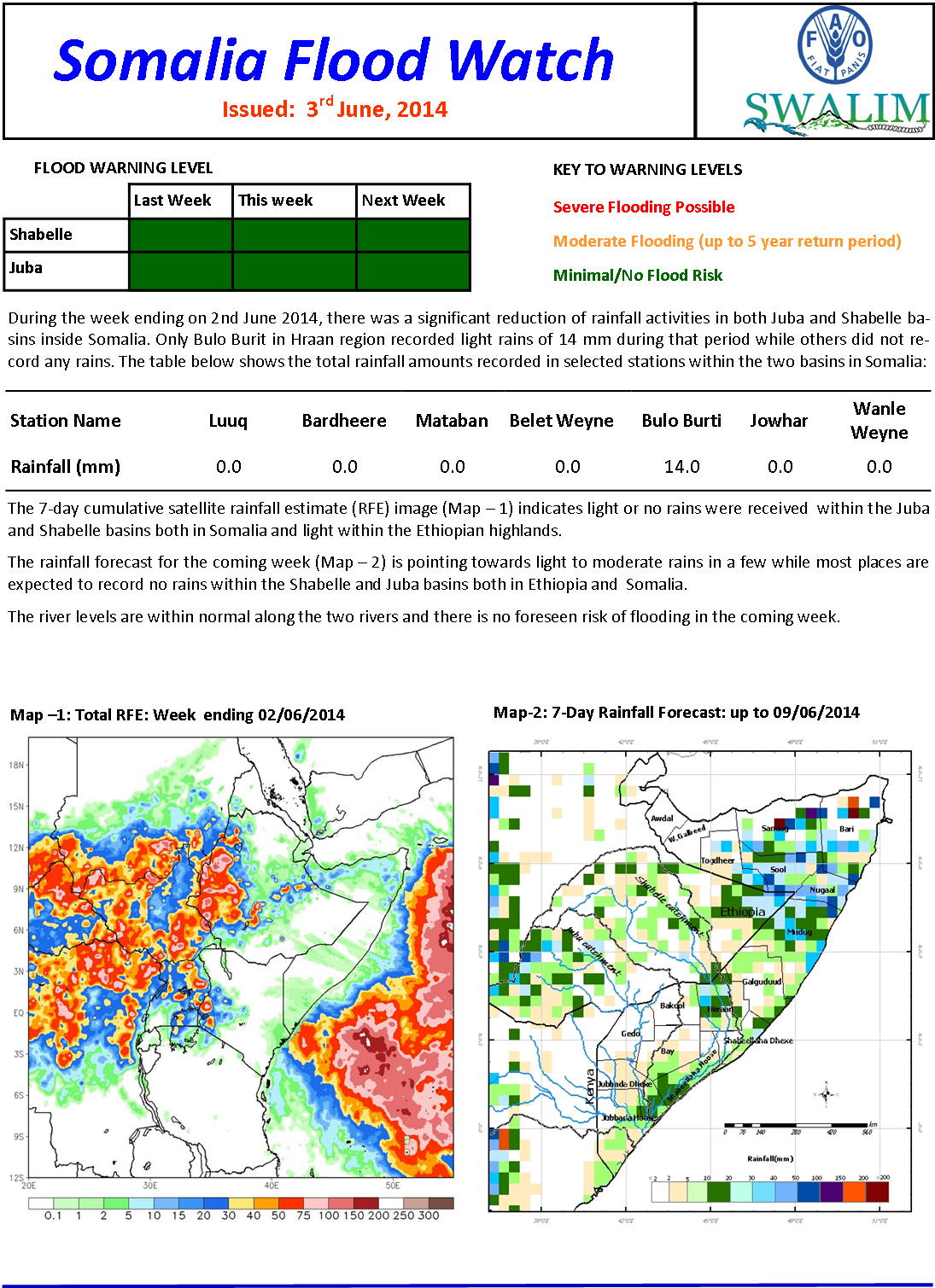
Flood Watch Bulletin 03-06-2014
During the week ending on 2nd June 2014, there was a significant reduction of rainfall activities in both Juba and Shabelle ba-sins inside Somalia. Only Bulo Burit in Hraan region recorded light rains of 14 mm during that period while others did not re-cord any rains.
Publication Type:
Flood watch bulletin
Publication Date:
Author:
Corporate Author:
Somalia Dekadal Rainfall Bulletin - Dekad 14 2014
During the 14th Dekad (11th – 20th May 2014), moderate to heavy rains were recorded in many parts of the country with the southern parts receiving the highest amounts of rains but with poor spatial and temporal distribution. However,
some places in parts of Bari and Nugaal regions in the north have not received any rains since the beginning of the station. Below is a brief summary of the rainfall situation by region for this dekad.
Publication Type:
Dekadal Rainfall Update
Publication Date:
Author:
Corporate Author:

Flood Watch Bulletin 06-05-2014
The rainfall within the Juba and Shabelle basins over the last week varied greatly both in space and quantity inside Somalia. A few places recorded moderate rains while others received little or no rains.
Publication Type:
Flood watch bulletin
Publication Date:
Author:
Corporate Author:

Flood Watch Bulletin 13-05-2014
There was an increase of rainfall activities in most parts of the Juba and Shabelle river basins inside Somalia. A few places recorded heavy rains on 8th and 9th May 2014 causing localized flooding in the areas. The upper parts of Gedo however did not record any rains.
Publication Type:
Flood watch bulletin
Publication Date:
Author:
Corporate Author:
Pages
 RSS feed [compliant with the Agris AP] |
  Agris AP XML