Library Catalog
Latest Documents and Publications listed. Use search terms in the box below to find what you need
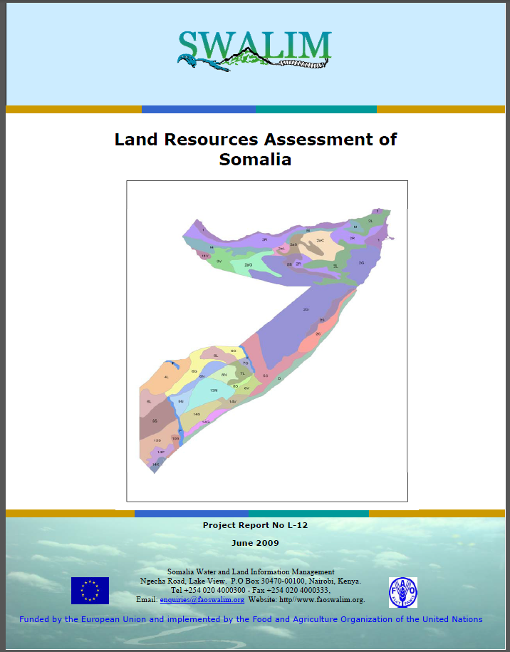
L-12 Land Resources Assessment of Somalia
This report gives an overview of the land resources for the whole country. The
main focus is on the agricultural potential of the country and is expressed
through the delineation and description of agro-ecological zones. It provides a physical land suitability assessment of the two main SWALIM study areas in western Somaliland and southern Somalia, respectively. In addition
it gives a summary of research done in the study area in Puntland, dealing
with the applicability of remote sensing techniques for the assessment of pastoral resources while describing some of the results of the land degradation assessment study done in western Somaliland area.
Publication Type:
Technical report
Publication Date:
Author:
Venema J. H.
Corporate Author:
Somalia Water and Land Information Management, Nairobi (Kenya)
W-14 Analysis of General Climatic Conditions in Somalia in Support of Drought Monitoring
Africa is characterised by extremes of climate both spatially and temporally. Unlike in the temperate zones where growing seasons primarily reflect changes in temperature, Africa's rhythms of life reflect rainfall as the "limiting" factor. Generally, Africa has a wide variety of bimodal climates based around a summer wet season and a winter dry season. In fact, Africa's swings between dry and wet seasons are the most pronounced of any of the continents. Not surprisingly therefore, floods and droughts are a
common feature all over the continent. Due to the high drought vulnerability in most countries in Africa, it is not surprising that the drought hazards easily develop into disasters with serious consequences. The situation seems to be more serious in the Great Horn of Africa (GHA).
Publication Type:
Technical report
Publication Date:
Author:
Corporate Author:
Somalia Water and Land Information Management, Nairobi (Kenya)
W-14 Falanqaynta Xaaladaha Cimilada Guud ee gudaha Soomaaliya si Loo Taageero La-socodka Abaarta
Afrika waxa lagu sifeeyey inay ka jiraan xad-dhaafyo cimilo oo baaxad iyo waqti labadaba leh. Si ka duwan gobollada loolka dhexe (temperate zones) halkaas oo xilliyada waxbeerasho ay soo ifbaxaan ugu horayn isbeddello heerkul, hab-dhaca nolosha Afrika waxaa ka muuqanaya in roobku yahay cunsurka nololsha "xakameeya". Guud ahaan, Afrika waxay leedahay kala duwanaansho cimilado oo labo-noocle ku saleysan ku dhawaad xilli xagaa qoyan iyo xilli jiilaal qalalan. Dhab ahaantii, is-rogrogga u dhexeeya xilliyada engegan iyo kuwa qoyaan ee Afrika waa wax aad uga muuqan og ka qaaradaha kale. Sidaas daraaddeed yaab ma lahan, daadad iyo abaaro inay noqdaan muuqaal caadi ka ah dhammaan waddamada qaaradda. Sababta u nuglaan abaarta heerka sare ee dalalka Afrikabadnkood, maaha wax lala yaabo in khataraha abaartu ay si fudud dhaliyaan masiibooyin cawaaqibyo ba’an leh. Xaaladda waxay u egtahay in ay ka sii darayso gudaha Geeska Weyn ee Afrika (the Great Horn of Africa (GHA)).
Publication Type:
Technical report
Publication Date:
Author:
Corporate Author:
L-14 Qiimayn Xaaluf Dhul iyo Qaabhawleed Kormeerid gudaha Soomaaliya
Gudaha daraasadan, ayaa waxaa la sameeyey qiimayn heer-qarameed ee xaaluf dhul iyadoo la isticmaalayo masawirro jeedaalin dareeme fog oo waqti taxane laga soo bilaabay 1982 ilaa 2008 iyo ra'yi khabiiro oo ku saabsan taariikhda nabaadguurka gudaha Soomaaliya marka dib loo raaco tan iyo intii ay khubaradu xusuusan karto. Ujeedada cilmibaaristu waxay ahayd in la ogaado sababo nabaadguur xoogiya, noocyo, iyo saamayno uu ku leeyahay dhulka heer qaran iyo in la cayimo goobo maxalli ah oo lagu sameeyo qiimayn dhamaystiran. Waxsoosaarrada ka soo baxay daraasadan waxaa loo arkay in ay taageeraan go'aamada siyaasadeed ee lagula dagaallamayo xaalufka dhulka heer qaran iyo in tilmaamaha guud la bixiyo qeybaha dalka ee la kulmaya nabaadguur daran si markaas loo oogi karo qorsheyn haboon ee khayraadka qaran. Qiimeynta waxaa loo kala dhigdhigay heerheer si waafaqsan hababka unugyada isticmaalka dhulka ee gudaha dalka. Waxaa weheliya qiimeynta, in daraasaddu ay sidoo kale taabagelisay macluumad saldhig wanaagsan si mustaqbalka loola socodo xaaluka dhulka gudaha Soomaaliya.
Publication Type:
Technical report
Publication Date:
Author:
Corporate Author:
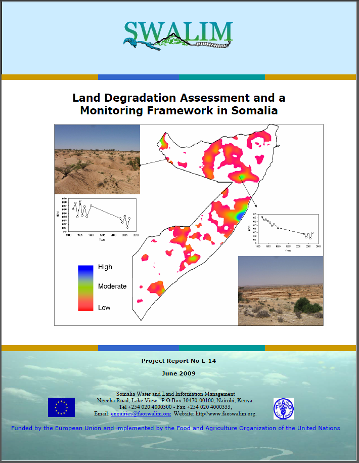
L-14 Land Degradation Assessment and a Monitoring Framework in Somalia
In this study, national-level assessment of land degradation was done using time series remote sensing images from 1982 till 2008 and expert opinion about the history of the degradation in Somalia dating back as far as the experts could remember. The objective of the study was to identify potential causes, types, and impacts of land degradation at the national level and to identify local spots for comprehensive assessment. The outputs from this study was envisaged to support policy decisions for combating land degradation at the national level and to give the general guidelines of the sections of the country experiencing severe degradation so that appropriate planning of the national resources could be instituted. The assessment was stratified according to land use systems units in the country. In addition to the assessment, the study also established good baseline information for future monitoring of land degradation in Somalia.
Publication Type:
Technical report
Publication Date:
Author:
Omuto C, Vargas R .R., Alim M.S
Corporate Author:
Somalia Water and Land Information Management, Nairobi (Kenya)
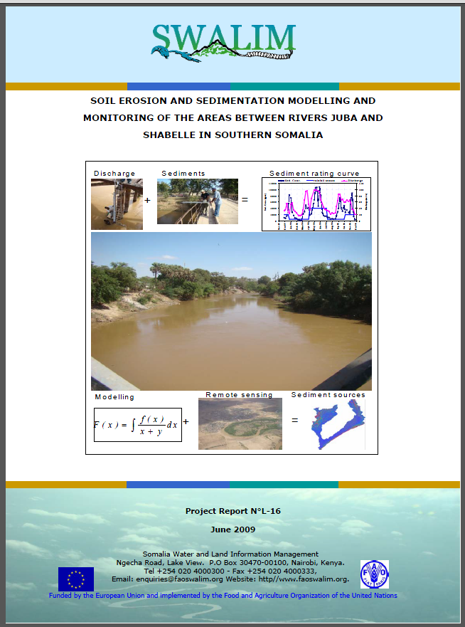
L-16 Soil Erosion and Sedimentation Modelling and Monitoring of the Areas Between Rivers Juba and Shabelle in Southern Somalia
Soil erosion is a complex dynamic process by which the productive soil surface is detached, transported, and accumulated at a distant place. It produces exposed subsurface where the soil has been detached and the detached deposited in low-lying areas of the landscape or in water bodies downstream in a process known as sedimentation.
The present study by FAO-SWALIM was initiated with the general objective of preparing an assessment of soil erosion and sedimentation of the riverine areas between rivers Juba and Shabelle and to provide input into soil erosion and sedimentation monitoring framework which will contribute to improved management of the irrigation systems in south Somalia. The study identified areas prone to high soil erosion rates and sediment flux into river Juba and Shabelle in south Somalia.
Publication Type:
Technical report
Publication Date:
Author:
Omuto C, Vargas R .R., Paron, P.
Corporate Author:
Somalia Water and Land Information Management, Nairobi (Kenya)
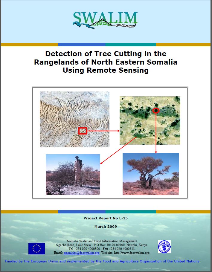
L-15 Detection of Tree Cutting in the Rangelands of NE Somalia
This report outlines how very high resolution satellite imagery was used to estimate the rate of tree-cutting in Puntland. The study used visual interpretation of Ikonos and Quickbird images for 2001 and 2006 respectively to generate tree density maps for the two years. Through collaboration between SWALIM and the EC Joint Research Centre at Ispra, Italy, an automatic procedure for identifying and classifying trees was also tested. Both techniques produced similar results, which showed an overall decrease in tree density between 2001 and 2006. The results also showed some areas where the tree densities have increased due to environmental conservation through community interventions. The method used can be up-scaled to other parts of Somalia to support afforestation campaigns and environmental conservation.
Publication Type:
Technical report
Publication Date:
Author:
Oduori S. M., Vargas R .R.
Corporate Author:
SWALIM
L-15 Baaris Geedo Jarid gudaha Dhulalka Daaqsinta Waqooyi-bari Soomaaliya
Warbixintaan waxay qeexeysaa sida masawirro dayax-gacmeed aad iyo aad u bayaansan loogu isticmaalay in la qiyaaso xaddiga geed-jarista gudaha Puntland. Daraasaddu waxay isticmaashay muuqaal tarjumid lagu sameeyey sawirro ah Ikonos iyo Quickbird oo midba yahay sanadkii 2001 iyo 2006 si loo soosaaro khariidado cumur geed ee labada sano. Wadashaqayn ka dhaxaysa SWALIM iyo Xarunta Cilmibaaris Wadajirka EC oo ku taal Ispra, Talyaaniga (EC Joint Research Centre at Ispra, Italy) ayaa sidoo kale lagu jitaabiyey habraac automaatik ah si loo aqoonsado oo loo abla-ableeyo geedaha. Labada farsamaba waxay soosaareen natiijooyin isu eg, kuwaas oo muujiyey guud ahaan hoosudhac ku yimid cumur geedaha intii u dhexeysay sanadkii 2001 iyo 2006. Natiijoojinku waxay sidoo kale muujiyeen meelo qaarkood oo ay cumurradu kordheen taas oo ay ugu wacan tahay dhawris deegaaneed ku timid hawlgallo bulsho. Xeeladda la isticmaalay waxaa lagu sii baahin karaa qaybaha kale ee Soomaaliya si loo caawiyo ololeyaal dhir beeris iyo dhawris deegaaneed.
Publication Type:
Technical report
Publication Date:
Author:
Corporate Author:
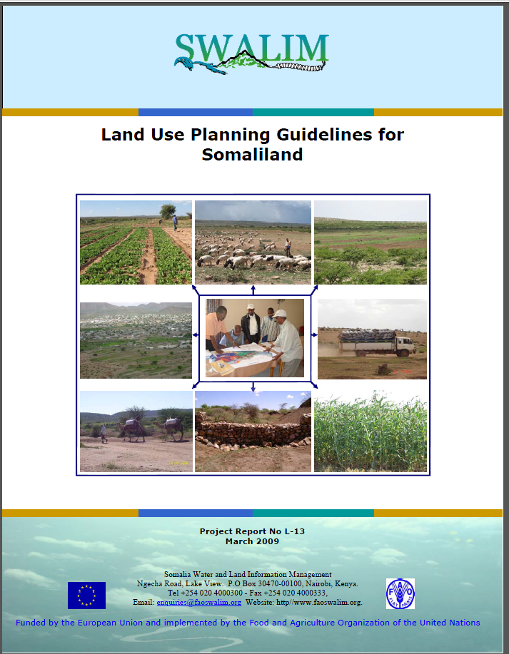
L-13 Land Use Planning Guidelines
During the last 120 years, Somalia and Somaliland have experienced great political and socio-economic changes. The change in land use policies and land use planning activities over those periods is considerable, with new governments often reversing measures taken by previous regimes. More or less continuous developments over all periods include growing population, expansion of agriculture (cropping), increased number of water points, sedentarization, tree cutting and expansion of rangeland enclosures.The purpose of the Land Use Planning Guidelines for Somaliland is to explain the
principles and procedures of land use planning in general, and how it can be applied in Somaliland at various levels in particular.
Publication Type:
Technical report
Publication Date:
Author:
Venema J. H., Vargas R .R., Oduori S
Corporate Author:
Somalia Water and Land Information Management, Nairobi (Kenya)
L-13 Tilmaamo Qorshayn Isticmaal Dhul
Inta lagu jirey 120 sano oo dambe, Soomaaliya iyo Somaliland waxaa soo maray isbedello waaweyn oo siyaasadeed iyo kuwo dhaqan-dhaqaale. Isbedelka siyaasadaha isticmaalka dhulka iyo hawlaha qorshaynta isticmaalka dhulka ee muddoyinkaas waa badnaayeen, iyadoo dawladahii cusub ay badanaa baddalayeen tallaabooyinkii ay qaadeen xukuumadhii hore. Ha badnaato ama ha yaraato horumar joogtada ah ee dhamman muddoyinka oo idil waxaa ka mid ah dadweyne kordhaya, waxbeerasho ballaaraneysa (dhul beerid), tirada goobaha biyaha oo kordhey, reer magaaloobid, geedo jaris iyo ballaarasho xirmooyin xoolo-daaqeen. Ulajeedada Tilmaameyaasha Qorshaynta Isticmaalka Dhulka ee Somaliland waa in si guud loo fasiro mabaadii'ida iyo habraacyada qorshaynta isticmaalka dhulka, iyo sida loogu dabaqi karo gudaha gaar ahaan Somaliland si heerar kala duwan ah.
Publication Type:
Technical report
Publication Date:
Author:
Corporate Author:
Pages
 RSS feed [compliant with the Agris AP] |
  Agris AP XML