Library Catalog
Latest Documents and Publications listed. Use search terms in the box below to find what you need
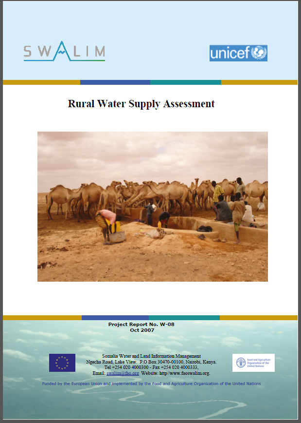
W-08 Rural water supply assessment
Water resources in Somalia are limited both in quantity and quality, with frequent droughts and floods further worsening the water security situation in the country.
Before the onset of civil war in early 1991, the main institution in charge of water resources management in Somalia was the Ministry of Water and Mineral Resources (MWMR) through the National Water Centre (NWC). Exploitation of domestic water supplies was the responsibility of the Water Development Agency (WDA), while the ministry of Agriculture planned and operated water for agricultural activities in the Shabelle River. For the Juba River, development was the responsibility of the Ministry of National Planning and Juba Valley Development. Institutional arrangements of water resources management showed fragmentation, without a clear divide between the functions of national and local agencies. With the outbreak of civil war in 1991, much of the water infrastructure in Somalia was destroyed and social services such as health,education, water and sanitation were seriously affected.Being located in an extremely water-scarce area, the environmental, social and economic
development of Somalia is to a large extent dependent on improved water security through effective management of water resources.
Publication Type:
Technical report
Publication Date:
Author:
Muthusi F.M.
Corporate Author:
Somalia Water and Land Information Management, Nairobi (Kenya)
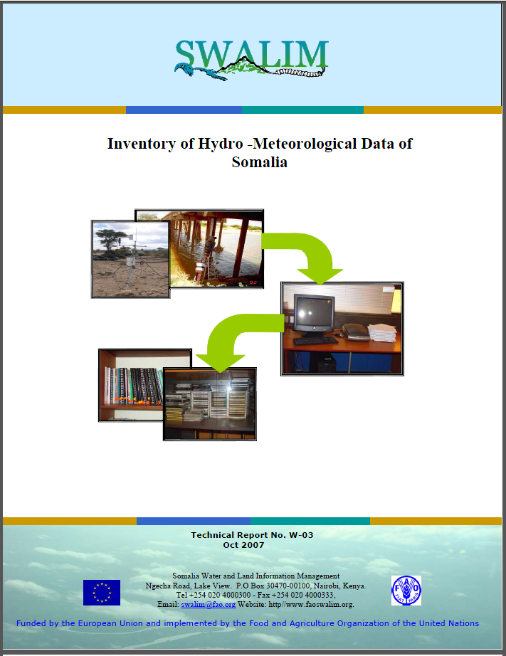
W-03 Inventory of Hydro-Meteorological Data of Somalia
Developing countries; especially in Africa, face great challenges in data and information management. While it is known that centralised database management is a good practice in the field of research, not many countries have managed to achieve this, even with the growing rate of knowledge of information and communication technology. Somalia faces even greater challenges than these countries due to the prolonged civil war. One and a half decade of the civil war in the country have resulted in loss and damage of most water & land related information collected in the previous half century.
This report presents an inventory of the historical hydro-meteorological data that have been
accumulated from various sources, and the hydrometeorological data that are currently
being collected by SWALIM in collaboration with partner agencies
Publication Type:
Technical report
Publication Date:
Author:
Muchiri, P. W.
Corporate Author:
Somalia Water and Land Information Management, Nairobi (Kenya)
W-09 - Suroogalnimo Dhurasho Biyo-roobaad gudaha Soomaaliya
Soomaaliya waxay dabooshaa geyi ah 637,657 km2 oo dadka ku nool lagu qiyaasay in ay yihiin 7.5 milyan sanadkii 2003. Dhaqaalaha Soomaaliya wuxuu badanaa ku dhisan yahay beeraha (beeraha iyo xoolaha, tan dambe ayaa ah halbowlaha ugu weyn). Dhaqaalahu wuxuu si heer sare ah ugu tiirsan yahay helitaan biyood, taas oo iyana markeeda ku xiran roobka. Roobabka Soomaaliya ma aha mid yar oo kaliya, ka hoos 100 mm/sanadkii meelaha qaar, laakiin waxa uu leedahay isbedbedel sare oo xilliile iyo mid masaaxadeed (Lifaaqa 1 ilaa 5). Celceliska roobabka sanadle wuxuu dhexeeyaa 215 mm gudaha gobollada Waqooyi-bari ilaa uu ku dhawaado 550 mm gudaha gobollada Koonfureed iyo Bartamaha (SWALIM, 2007).
Isudheelitirka biyaha dalka wuxuu muujinayaa uumibax ka badan roobabka ku daá gudaha dalka oo idil. Waxaa intaas dheer, xaalado kale oo biyo iyo oogo dhul (hydro-physical conditions) oo saamayn xun (tabane) ku leh helitaanka biyo saafi ah waxa ka mid ah xaaluf dhul iyo calwidda oogooyinka biyaha. Xaaladda waxaa sii xumaatay 16 sano oo dagaal sokeeye jirey, gaar ahaan gudaha gobollada koonfureed. Tiro ka mid ah ururada maxaliga iyo kuwa caalamiyeed waxay bilaabeen barnaamijyo dib-u-dhisid, dhawris deegaameed iyo taageerid hab-nololeed rayid. Khubaradadu waxay qiyaasayaan in Soomaaliya ay ka mid tahay 13 dal oo Afrikaan ah oo wajihi doona biyo yaraan sanadka 2025. Dal waxaa la yiraahadaa waa mid biyo yar marka biyaha sannadlaha ee halkii qofkii heli karo ay ka hoosayso 1000 m3. Durba, Soomaaliya waxay leedahay wax ka yar 500 m3/Qofkiiba/sanadkii (UNECA, 2000). Tan waxaa loo tiriyaa roob-di'id goosgoos u qaybsamida xilliile iyo tan masaaxadeed oo xaddiga celceliska sanadle uu u dhexeeya 100 iyo 800 mm, uumibax sare, iyo waxqabadyo aadame oo sii xumeeya nabaad guurka.
Publication Type:
Technical report
Publication Date:
Author:
Corporate Author:
W-03 Diiwaagelin Xog cilmiyeed Biyo-hawo-saadaalin (hydro-meteorological data) ee Soomaaliya
Dalalka soo koraya; gaar ahaan Afrika, waxay wajahayaan caqabado waaweyn oo ka haysta maaraynta xogta iyo macluumaadka. Halka sida la og yahay in meeldhexe ka maareynta xogta gundhig ah ay dhaqan wanaagsan tahay markii ay arrin cilmi-baaris tahay, dalal aan badnayn ma maareyn inay ka guulgaaraan arritaan, inkasta oo uu kordhayo xaddiga aqoonta macluumaadka iyo farsamada isgaarsiinta. Soomaaliya waxay weliba wajahaysaa caqabado ka waaweyn kuwa dalalkaan iyadoo ay ugu wacan tahay dagaalka sokeeye ee daba dheeraaday. Hal iyo bar tobanaad sano oo dagaalka sokeeye ka jirey gudaha dalka wuxuu u keenay khasaare iyo dhaawac wax badan oo la xiriira macluumaad biyo & dhulka oo nus qarnigii hore la ururiyay. Warbixintani waxay soo bandhigaysaa diiwaangelin xog taariikheed cilmiyeed biyo-hawo-saadaalin (hydro-meteorological) taasoo laga ururiyay ilo kala duwan, iyo xogta hydrometeorological-ka hadda ay uruurinayso SWALIM iyadoo kaashanaysa hay'ado la hawlgala.
Publication Type:
Technical report
Publication Date:
Author:
Corporate Author:

Inventory of Hydro -Meteorological Data of Somalia
Developing countriesespecially in Africa, face great challenges in data and information management. While it is known that centralised database management is a good practice in the field of research, not many countries have managed to achieve this, even with the growing rate of knowledge of information and communication technology. Somalia faces even greater challenges than these countries due to the prolonged civil war. One and a half decade of the civil war in the country have resulted in loss and damage of most water and land related information collected in the previous half century. On the other hand, great numbers of agencies are working in Somalia with different objectives and activities, which have led to disintegration of information. Having realised this, land and water data management and exchange have become important components within the SWALIM project. SWALIM is trying to recover lost information from different sources all over the world and at the same time re-establish data collection networks in collaboration with partner agencies. One area of interest is information and data on hydro-meteorology. A lot of resources and efforts have been put into place by SWALIM in an effort to recover these lost data.
Publication Type:
Other
Publication Date:
Author:
Muchiri, P. W.
Corporate Author:
Somalia Water and Land Information Management, Nairobi (Kenya)
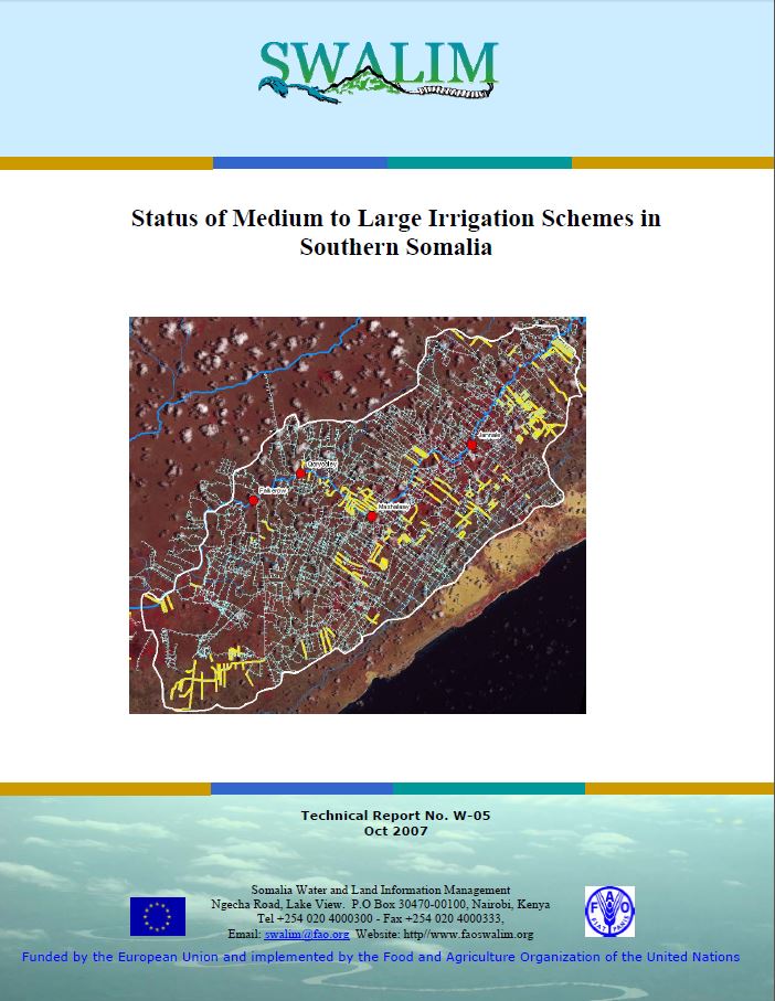
W-05 Xaaladda Mashaariic Waraab oo Dhexdhexaad ilaa Waaweyn ah oo gudaha Koonfurta Soomaaliya ka jira
Inkastoo beeraha waraabka ay ahaayeen isha-nolosha dhaqaalaha Soomaaliya ka hor bilowga dagaalka sokeeye ee 1990, wax badan oo macluumaadkii hababka waraabka oo dagaal hortii jirey ayaa lumay oo wax yar ayaa la og yahay xaaladdooda hadda ah. Warbixintani waxay muujinaysaa natiijooyinka ka soo baxay qiimayn ay SWALIM fulisay si loo ogaado xaaladda mashaariicda waraabka dhexdhexaad ilaa waaweynka ah oo ka jira gudaha Koonfurta Soomaaliya iyo kaabayaashooda waraabka. Waxaa la fuliyay dib-u- eegis qoraallo dhammeystiran, wareysiyo dad muhiim ah oo lala xiriiray iyo falanqayn ballaaran oo ah xog jeedaalin dareeme fog si loo gaaro natiijooyinka qiimaynta. Waxaa la soo saaray macluumaad gundhig ah oo ku saabsan biyoxireennada, habab kanaal iyo mashaariic waraab dabaded waxaa la dhisay xog-gundhig GIS ah ee kaabayaasha waraabka.
Waxaa la ogaaday qiyaas 5000 km oo kanaalo ah markii barbardhig loola sameeyey masawirro dayax-gacmeed. Waxaa la aqoonsaday xuduudaha iyo xaaladda 34 mashaariic waraab oo dhexdhexaad ilaa waaweyn ah. Xogta si fiican ayaa loo habeeyay oo waxaa la heli karaa markii loo isticmaalo desktop GIS software ama software web ku salaysan oo Geonetwork ah. Natiijooyinka soo baxay, oo ay weheliyaan talooyin, ayaa waxaa la filayaa in ay aasaas u noqdaan dadaallada dayactirka kaabayaasha ee bulshada deeqbixiyaha.
Publication Type:
Technical report
Publication Date:
Author:
Corporate Author:
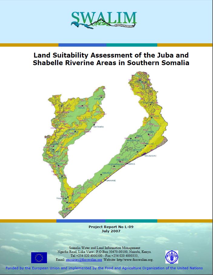
L-09 Land Suitability Assessment of the Juba and Shabelle
This report describes physical land suitability for rainfed agriculture, irrigated agriculture, extensive grazing (pastoralism) and forestry in the Juba and Shabelle riverine areas. Land suitability is presented in the form of tables, maps and narratives for specific types of land use defined by individual crops, grazing animals or forestry species. This report also gives details of the Somalia Automated Land Evaluation System (SOMALES), which is an application of the FAO Framework for Land Evaluation and ALES software for Somalia. The report is useful in guiding policy decisions on land use planning.
Publication Type:
Technical report
Publication Date:
Author:
Venema J. H., Vargas R .R.
Corporate Author:
SWALIM
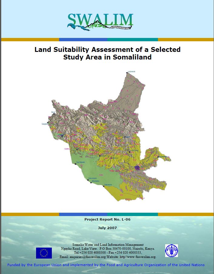
L-06 Haboonaanshiyo Dhul Aag laga Doortay gudaha Soomaaliyand
Si wax biirin u ah go’aanno siyaasad hogaamineedka qorshaynta isticmaalka dhulka, ayaa daraasadan waxay qeexeysaa awooda aagga daraasadda uu ku taageero noocyo isticmaal dhul oo gaar ah. Noocyada isticmaalka dhulka u muhiimsan la eegay waxay ahaayeen beer roobaad, daaq fidsan (xoolo-dhaqasho) iyo kayn. Haboonaanshiyo dhul waxaa lagu soo bandhigay qaab shaxeed, khariidado iyo faalooyin noocyo gaarah ee isticmaal dhul lagu qeexay dalagyo kala gaar ah, xoolo daaqeen ama noocyo dhir kayn. Warbixintan waxay sidoo kale bixinaysaa faahfaahino ku saabsan Hab Qiimayn Dhul oo Automaatik looga dhigay Soomaaliya (Somalia Automated Land Evaluation System (SOMALES )), taas oo ah hirgelin Qaab-hawleed FAO u isticmaasho Qiimayn Dhul iyo ALES software oo Soomaaliya loo diyaariyey. Warbixintan waa wax waxtar leh hogaamin go'aanno siyaasadeed oo ku taxaluqa qorshayn isticmaal dhul.
Publication Type:
Technical report
Publication Date:
Author:
Corporate Author:
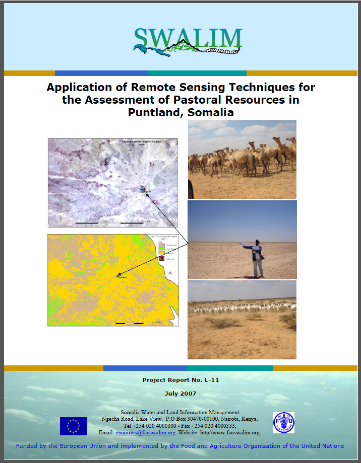
L-11 Application of Remote Sensing Techniques for the Assessment of Pastoral Resources in Puntland, Somalia
The conceptual aim of the study is to test and evaluate the applicability of remote sensing tools and products in the assessing pastoral resources. In the study remote sensing in combination with fieldwork were used to assess pastoral resources in two study areas falling within Sanag, Sool, Nugal and Mudug Regions of Puntland in northern Somalia. The key purpose of the
study was to test remote sensing techniques as tools for assessing and monitoring pastoral resources.
Publication Type:
Technical report
Publication Date:
Author:
Oroda A.S., Oduori S. M., Vargas R.R
Corporate Author:
Somalia Water and Land Information Management, Nairobi (Kenya)
L-11 Adeegsi Farsamooyin Jeedaalin Dareeme Fog si loo Qiimeeyo Khayraadka xoolo-daaqeenka gudaha Puntland, Soomaaliya
Ujeedada fikradeed ee daraasadda waa in la tijaabiyo oo la qiimeyn adeegsiga aalado jeedaalin dareeme fog iyo wax soo saar marka la qiimaynayo khayraadka xoolo-daaqeenka. Gudaha daraasadda jeedaalin dareeme fog oo ay ku biirsan tahay hawl duur ayaa la isticmaalay si loo qiimeeyo khayraad xoolo-daaqeen gudah laba goobood oo la darsayey oo ku yaal gudaha Gobollada Sanaag, Sool, Nugaal iyo Mudug ee Puntland gudaha waqooyiga Soomaaliya. Ujeedada daraasadda ugu muhiimsan waxay ahayd in la tijaabiyo farsamooyin Jeedaalin fog oo ah aalado lagu qiimeeyo oo lagula socodo khayraad xoolo-dhaqeen.
Publication Type:
Technical report
Publication Date:
Author:
Corporate Author:
Pages
 RSS feed [compliant with the Agris AP] |
  Agris AP XML