Useful Links
Land suitability
Land suitability assessment is the process of estimating the potential of land for alternative kinds of land use. SWALIM has undertaken detailed land suitability studies and produced a set of land suitability maps for different land uses in two pilot areas of interest (the Garbiley and Boroma areas in Somaliland and the Juba and Shabelle riverine areas in the South) . Land suitability maps and reports have subsequently been developed.
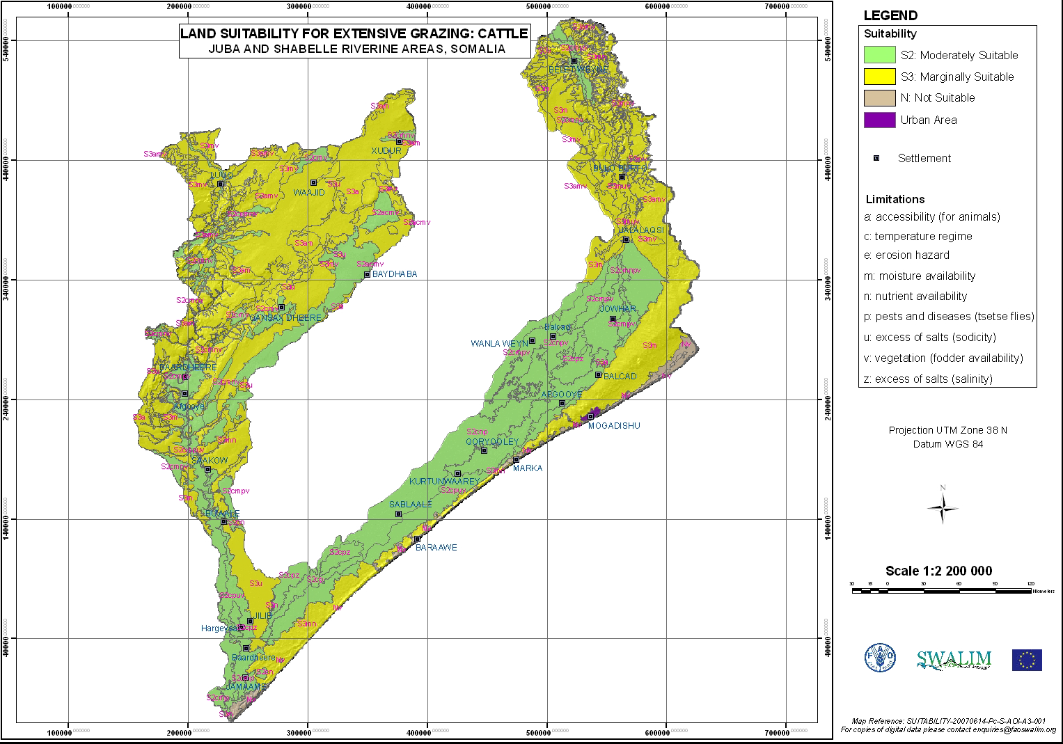

Land suitability map cattle grazing - Juba & Shabelle riverine areas Land suitability map for irrigated agriculture - Sugarcane Juba & Shabelle riverine areas
Land suitability for the areas studied by SWALIM is presented in the form of tables, maps and narratives for specific types of land use defined by individual crops, grazing animals or forestry species. The reports - Land Suitability Assessment of a Selected Study Area in Somaliland: L-06 and
Land Suitability Assessment of the Juba and Shabelle Riverine Areas in Southern Somalia: L-09 are available in the digital documents repository or through the publications section. The reports also give details of the Somalia Automated Land Evaluation System (SOMALES), which is the application for Somalia of the FAO Framework for Land Evaluation and ALES software.