Useful Links
Weather Monitoring
 Internal strife in Somalia led to the collapse of the hydro-meteorological monitoring network after 1990. Under the SWALIM project, FAO and partners have made great efforts to re-establish this vital information network. Since 2002, FAO-SWALIM has taken the lead to “re-collect” all the datasets that were scattered and are often only available in different formats from various agencies.
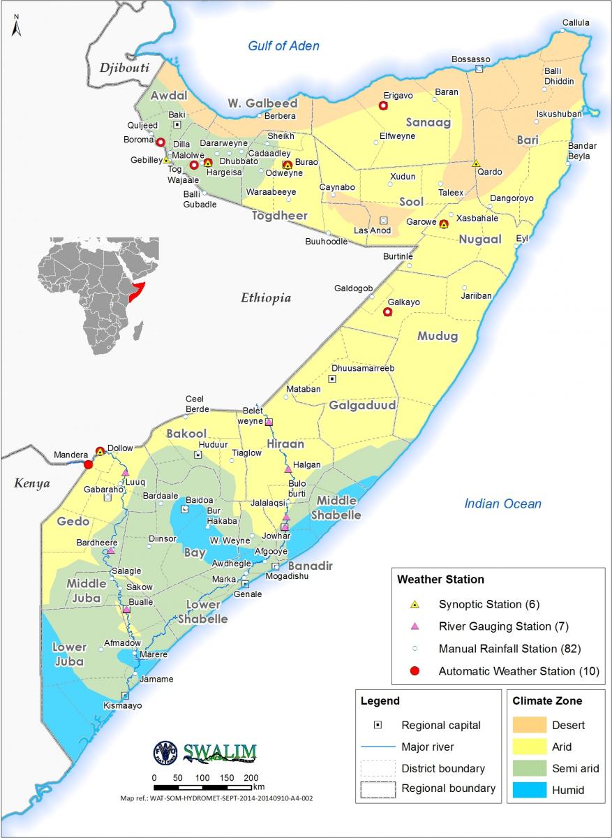
Currently, there are over 100 manual rainfall stations, eight synoptic weather stations and 11 automatic weather stations in the country. Data from the manual stations is transmitted to SWALIM’s Nairobi office on a regular basis through satellite, gprs, e-mail or telephone. Seven automatic weather stations are strategically located in the northern parts of the country, including Hargeysa, Borama, Sheikh, Aburin, Burao, Dollow, Garowe and Galckayo. The other automatic weather stations are located in the south in Baidoa and Mogadishu. It is hoped that, when the situation allows, more automatic weather stations will be installed in the southern regions. The stations record a variety of weather elements, including rainfall, temperature, relative humidity, atmospheric pressure, wind speed, wind direction and solar radiation. Data from these automatic stations is received by SWALIM in near-real-time through satellite feeds every four hours. This weather monitoring has been made possible through the partnership between SWALIM and the Somali line ministries, as well as other agencies present on the ground. The data is then processed and disseminated to the public as information through SWALIMs information dissemination channels.
Map showing location of stations in Somalia

