SWALIM Builds IMC-Puntland and Line Ministry Staff on Land Degradation Monitoring and Sand Dune Mapping
As part of its ongoing Capacity Development Programme, FAO SWALIM conducted nine-day training on Land Degradation Monitoring and Sand Dune Mapping from 3 - 13 November 2025 in Martisoor Hotel, Garowe, Puntland. The training aimed to strengthen the capacity of government ministries and institutions to monitor soil erosion, vegetation change, and sand-dune expansion using Earth Observation tools. A total of 20 participants attended the training, drawn from the Information Management Centre (IMC), the Puntland Water Development Agency (PWDA), and various line ministries. This initiative supports SWALIM’s core mandates on environmental monitoring, natural resources assessment, and building national institutional capacity for sustainable land and water management across Somalia.
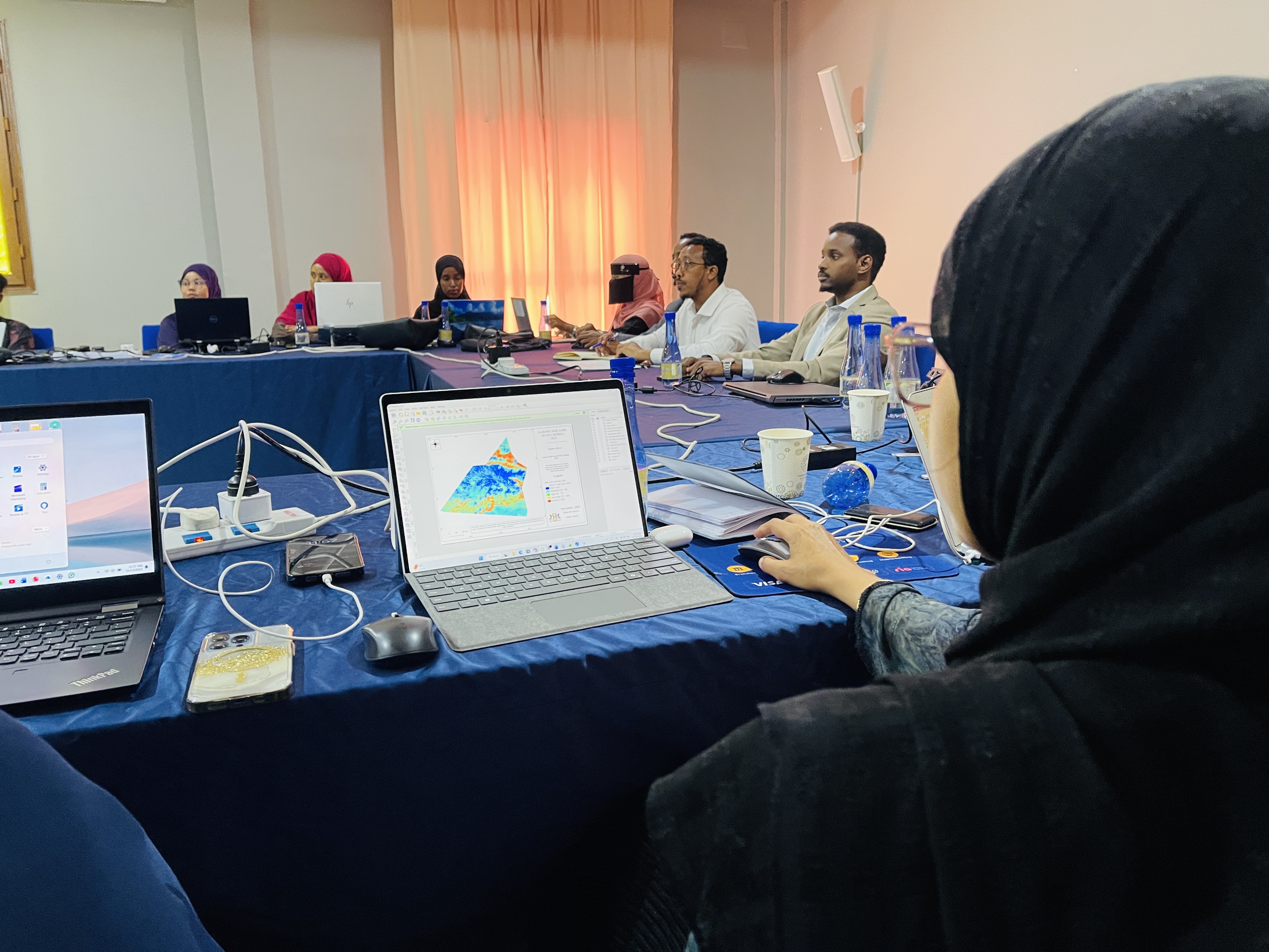
The programme combined theoretical sessions with hands-on geospatial analysis using Google Earth Engine (GEE) and QGIS. The training began by establishing a foundation on the meaning, drivers, and forms of land degradation. The first module focused on soil degradation, where participants applied the Revised Universal Soil Loss Equation (RUSLE) to model and quantify soil erosion. This was followed by a module on vegetation degradation, where participants used NDVI anomaly as a proxy indicator for detecting short-term vegetation decline relative to a 10-year long-term mean. Facilitators emphasized correct interpretation of NDVI anomalies - highlighting that short-term reductions caused by seasonal variation, rainfall fluctuations, or drought do not necessarily indicate land degradation. Integrating rainfall and seasonal context was demonstrated as a critical step in accurate land degradation assessment.
Another component of the programme addressed sand dune mapping, where participants used Normalized Difference Sand Index (NDSI) to identify potential sand-accumulation zones, especially in districts such as Jariiban. It was emphasized that field verification is essential, as NDSI values show only potential sand-dune areas. To complete the workflow, participants exported their outputs from GEE and used QGIS to design professionally structured land degradation maps. Sessions focused on symbology, layer styling, layout design, metadata documentation, and adherence to cartographic standards. Through guided critique, participants enhanced the clarity of their soil loss, vegetation anomaly and sand-dune maps.
The closing session was attended by the Officer in Charge of FAO Garowe, the Director of IMC Puntland, and the Director General of the Ministry of Planning, who congratulated the participants and encouraged them to apply the skills gained. Certificates of participation were awarded, and participants expressed their appreciation to FAO SWALIM for the training and reaffirmed their commitment to using the knowledge acquired to support land-resource monitoring in their institutions.
English
Thumbnail Image:
Feature Article:
Yes
- Log in to post comments