Library Catalog
Latest Documents and Publications listed. Use search terms in the box below to find what you need
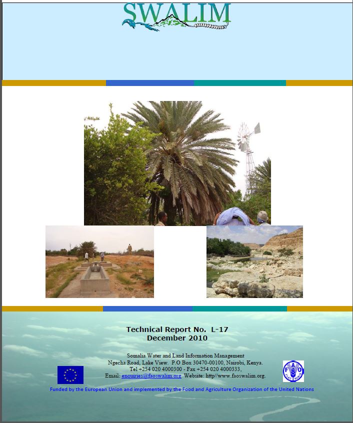
L-17 Mapping and Assessment of Irrigated Farms in Puntland
Irrigated agricultural areas of Puntland were mapped using Google Earth images and field based interviews with the farmers to characterize land use. Information displayed in this report includes maps of the irrigated agricultural areas and tables and pictures to show the characteristics of the irrigated agricultural areas of Puntland. The study outlines the state of the irrigated agricultural areas in Puntland and consequently points out areas which need intervention. However, this study is being updated and concluded in SWALIM V.
Publication Type:
Technical report
Publication Date:
Author:
Oduori S. M., Alim M
Corporate Author:
SWALIM
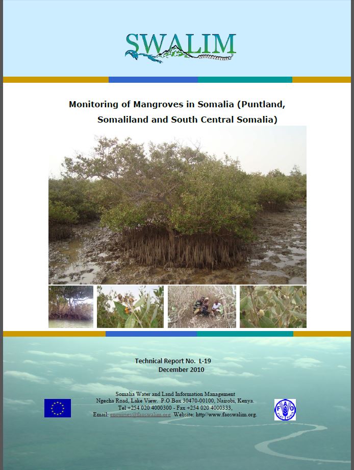
L-19 - Tabaha loogu Talagalay Kormeerista Geedaha Shawrada (Qandal, Takhay) Soomaaliya
Daraasadani waxay anfacaysa inay ahaato kob laga jaan qaado oo ku toosan qaanqaaminta la socodka deegaanka geedka shawrada Soomaaliyeedka. Waxay sidoo kale aasaaseysaa qayb ka mid ah waqbashada hawsha kormeeridda xaalufka dhulka ee ay bilawday SWALIM. Macluumadka lagu curiyey daraasadaan waxaa ka mid ah khariidad muujinaysa goobaha geedaha shawrada (qandal, takhay), shaxyo iyo naqshado goobaabo qaybqaybsan si loo muujiyo manaafacaadsiga iyo maaraynta khayraadka geedaha shawrada (mangroves) ee Soomaaliya. Kharriidadaha ku jira daraasadaan waxaa la curiyey iyadoo la isticmaalayo masawirro Google Earth ah iyo sahanno goobaha duurka dabiiciga ah oo ay weheliso wareysiyo laga soo qaaday dadka deegaanka si ay u caawiyaan ka faaleynta kaymaha Shawrada (mangroves) marka la eego maareytooda iyo isticmaalkooda. Macluumaadka ku jira daraasadan wuxuu caawini doonaa in la hagaajiyo maareynta iyo isticmaalka kaymaha shawrada (mangroves) Soomaaliya. Daraasaddu waxay ku fidsan tahay dhammaan shawrada (mangroves) Saylac, Barbera, Caluula xagga woqooyiga iyo Kismaayo xagga koonfurta.
Publication Type:
Technical report
Publication Date:
Author:
Corporate Author:
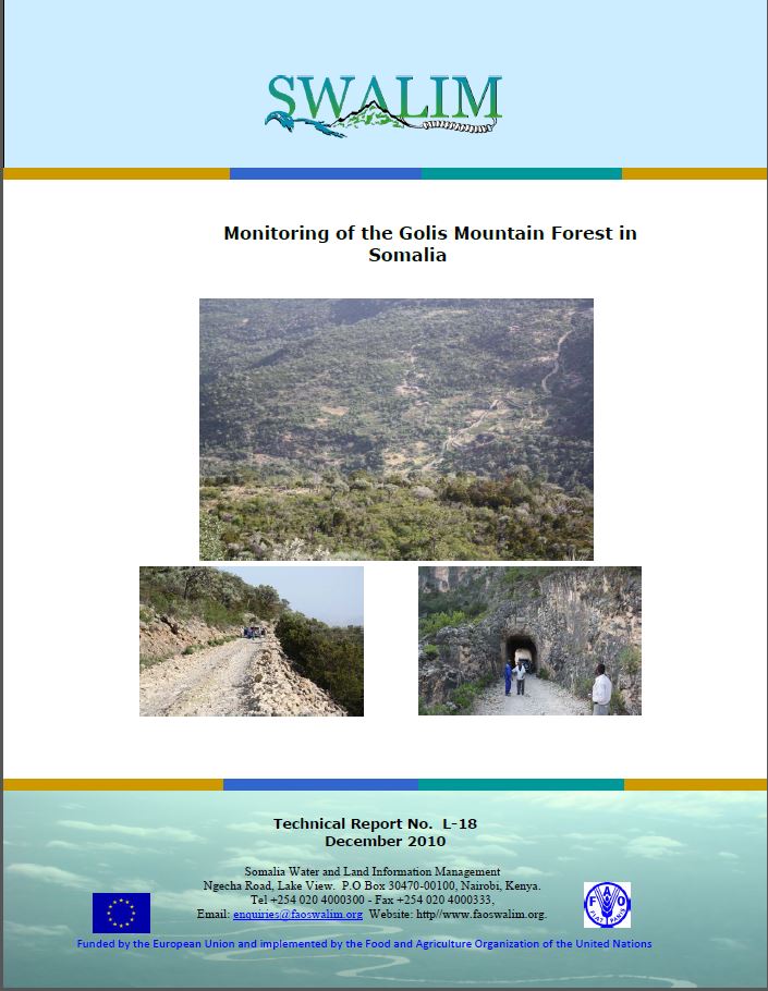
L-18 Monitoring of Golis Forest in Somalia- Report No
This study serves as a starting point towards a monitoring initiative for the Golis mountain forest. It forms part of the input to the land degradation monitoring activity initiated by SWALIM. Information generated in the study includes a map showing land cover in the Golis forest, tables and pie charts to show utilization and management of the resources of the forest. The maps in this study were generated using Landsat TM images aided by Google Earth images and ecological field surveys coupled with interviews to the local people to help characterize the forest in terms of management and utilization concerns. Information contained in this study will help in the improved management and utilization of the forest.
Publication Type:
Technical report
Publication Date:
Author:
Oduori S. M., Alim M.S
Corporate Author:
SWALIM

Integrated draft:The environment conservation act and the agricultural land ownership law
The environment conservation act and the agricultural land ownership law
Publication Type:
Other
Publication Date:
Author:
Corporate Author:
Towards a spatial Data Infrastructure for Somalia using open source standards
SDI is a well-known concept in Africa, many countries are on the way to having a formal SDI strategy Certain countries, such as Somalia, are starting the process of nation building after years of war. These countries stand to leapfrog other African countries by implementing current SDI best practices. The FAO‐SWALIM project is in the unique position to be able to assist Somali authorities in providing some of the building blocks for SDI development, even though SWALIM does not have the legal mandate to do so. This paper highlights what SWALIM can currently contribute and what significant work (and resources) are still required for a Somalia National SDI.
Publication Type:
Journal Article
Publication Date:
Author:
Hagen C, Somalia Water and Land Information Management, Nairobi (Kenya)
Corporate Author:
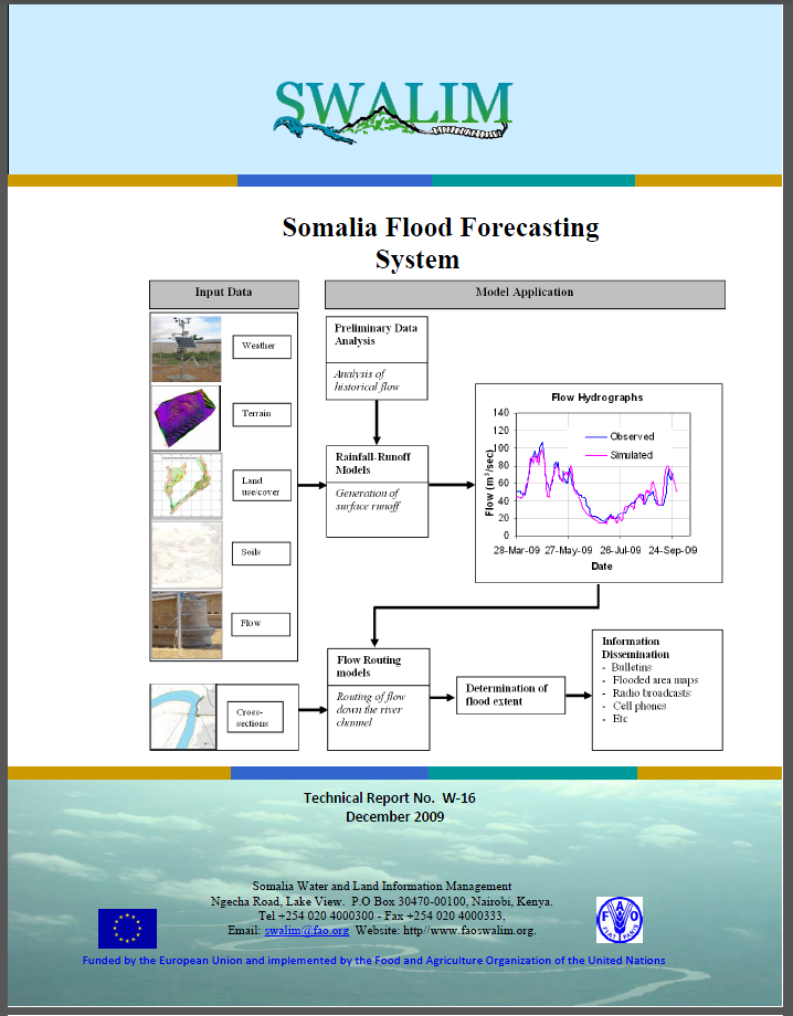
W-16 Habka Odorosidda Fatahaadda Soomaaliaya
Fatahaaddu waa arrin caadi ka ah gudaha dhulka ku hareeraysan dooxada Webiyada Juba iyo Shabeelle. Labada webi waxay muujiyaan astaamo xilliile marka la eegayo qululkooda (their hydrological regime) oo si xoog leh u janjeera fatahid gaar ahaan inta lagu jiro xilli roobaadka Deyrta (Oktoobar ilaa Nofeembar). Qaar ka mid ah dhacdooyinka daadadka waaweyn ee labada dooxo waxay dhaceen dhowr tobnaad sano oo la soo dhaafay 1961, 1977, 1981, 1997 iyo 2006. Fatahaadda webiyada waxaa badanaa sababa roobab badan oo ka da’a biyo-qabadyada sare ee labada webi oo ku yaal gudaha dhulka sare ee Itoobiya.
Si kastaba ha ahaatee, waxaa sidoo kale xoog leh ka qayb qaadashada hawlo aadamaha ee daadadka, iyadoo beeralayda dagan dacaallada webiga ay gebiyada dhirta ka jaraan si ay ugu sahlanaato in biyahu u qulqulaan xagga gudaha beerahooda marka socodka biyuhu yaraadaan. Hawlahaan sharcidarada ah waxay kordheen ka dib markii ay burburtay dawladdii dhexe sanadkii 1991 waxaana sii xumeeyay roobabka El Nino 1997/98 oo ka qeyb qaatay burbur dheeraad ah oo ku dhacay kaabayaasha waraabka iyo xakamaynta fatahaadda.
Publication Type:
Technical report
Publication Date:
Author:
Corporate Author:
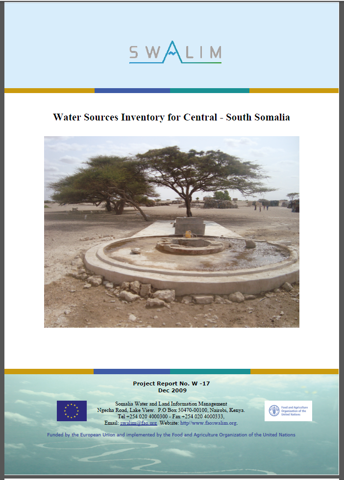
W-17 Water Sources Survey Invetory for Central South Somalia
Somalia’s surface water resources are concentrated mainly along the two perennial rivers, Juba and Shabelle. The flow in both rivers varies widely across the seasons. During the two rainy seasons, Deyr and Gu, the rivers often flood from very high flows, whereas in the dry season, flow is very minimal and can barely support irrigation. The riverine areas of the Juba and Shabelle occupy a small percentage of the Somalia’s territory. Majority of the country falls under arid and semi arid climatic conditions with very limited surface water resources. Domestic and commercial water needs in such areas are usually met through underground water sources.
Publication Type:
Technical report
Publication Date:
Author:
Muthusi F.M., Gadain H.M.
Corporate Author:
Somalia Water and Land Information Management, Nairobi (Kenya)
W-17 Sahan Diiwaagelin Ilo Biyood ee Koonfurta iyo Bartamaha Soomaaliya
Khayraadka biyaha dusha Soomaaliya waxay ku uruursan yihiin inta badan jiidda labada webi ee joogtada ah, Juba iyo Shabelle. Socodka labada webi si weyn ayuu u kala duwan yahay xilliyada dhexdooda. Inta lagu guda jiro labada xilli roobaad, Deyr iyo Gu, webiyadu badanaa waa fatahaan marka qulqulku uu aad u sareeyo, halka markii xilligu qalayl yahay, qulqulku waa wax aad u yar oo si dirqi ah ayuu u taageeraa waraabka. Dhulka dacallada webiyada Jubba iyo Shabelle wuxuu ku fadhiyaa tiro yar boqolkiiba marka loo eego dhulka dalka Soomaaliya oo idil. Aqlabiyadda dalku waxay ku sugan tahay xaalado cimilo oomane iyo bar-oomane ah oo khayraadka biyaha dusha ay aad u yar yihiin. Baahiyaha biyaha hooy iyo ganacsiyeedba ee meelahaas oo kale waxaa sida caadiga ah lagu haqabtiraa biyo laga helo ilaha biyaha dhul-hoose.
Publication Type:
Technical report
Publication Date:
Author:
Corporate Author:
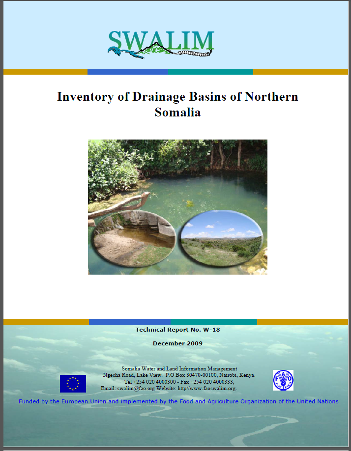
W-18 Inventory of Drainage Basins of Northern Somalia
Addressing issues of natural resources requires a holistic approach that recognizes the interdependence between competing demands and limited resources. Integrated watershed management is recognized as the best instrument for dealing with water and natural resources. This would also contribute to the eradication of extreme poverty and hunger (MDG 1) through improved food security (main focus of FAO) and sustainable
environmental management (MDG 7).
To enable start a process of integrated water resources management in Northern Somalia, the Somalia Water and Land Information Management (SWALIM) project has been mandated by the European Union (EU) to develop an inventory of the drainage basins of the area. A great percentage of the Somalia population relies directly on the natural resource base to meet their daily needs.
Publication Type:
Technical report
Publication Date:
Author:
Muchiri P.W.
Corporate Author:
Somalia Water and Land Information Management, Nairobi (Kenya)
W-18 Diiwaangelinta Marin-biyoodka Dooxooyinka ee Waqooyiga Soomaaliya
Wax ka qabashada arrimaha khayraadka dabiiciga waxay u baahan tahay habraac guud oo aqoonsan isku tiirsanaan ka dhexaysa dalabaad tartamaya iyo khayraadka kooban. Waxa la ogaaday in maareyn biyo-rog oo isku dhafan ay tahay aaladda ugu fiican ee lagula tacaalo biyaha iyo khayraadka dabiiciga. Tani waxay sidoo kale gacan ka geysan karilahayd dabargoynta saboolnimada ba'an iyo gaajada (MDG 1) iyada oo loo marayo hagaagin sugnaan cunto (FAO si weyn ayey diirad u saartaa) iyo maareyn deegaameed raandhiis leh (MDG 7). Si ay u suurogasho bilaw geedi-socod maareyn khayraad biyo oo isku dhafan gudaha waqqooyiga Soomaaliya, mashruuca Macluumaadka Maareynta Biyaha iyo Dhulka Soomaaliya (SWALIM) ayaa Midowga Yurub (EU) wuxuu u xilsaaray si ay hirgeliso diiwaangelinta dooxooyinka marin-biyoodka. Tiro-boqolle aad u badan oo dadweynaha Soomaaliya ka mid ah ayaa wuxuu toos ugu tiirsan khayraadka dabiiciga aasaasiga ah oo ay u daboolaan baahiyahooda nolol maalmeed.
Publication Type:
Technical report
Publication Date:
Author:
Corporate Author:
Pages
 RSS feed [compliant with the Agris AP] |
  Agris AP XML